


Voting District 10208, Sacramento County, California
About
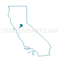
Outline

Summary
| Unique Area Identifier | 538331 |
| Name | Voting District 10208 |
| County | Sacramento County |
| State | California |
| Area (square miles) | 2.10 |
| Land Area (square miles) | 2.10 |
| Water Area (square miles) | 0.00 |
| % of Land Area | 100.00 |
| % of Water Area | 0.00 |
| Latitude of the Internal Point | 38.67026110 |
| Longtitude of the Internal Point | -121.39553650 |
Maps


Graphs
Select a template below for downloading or customizing gragh for Voting District 10208, Sacramento County, California


Neighbors
Neighoring Voting District (by Name) Neighboring Voting District on the Map
- Voting District 10073, Sacramento County, CA
- Voting District 10184, Sacramento County, CA
- Voting District 10193, Sacramento County, CA
- Voting District 10196, Sacramento County, CA
- Voting District 10199, Sacramento County, CA
- Voting District 10211, Sacramento County, CA
- Voting District 10232, Sacramento County, CA
- Voting District 10238, Sacramento County, CA
- Voting District 10241, Sacramento County, CA
- Voting District 10250, Sacramento County, CA
- Voting District 10259, Sacramento County, CA
- Voting District 10262, Sacramento County, CA
- Voting District 30592, Sacramento County, CA
Top 10 Neighboring County Subdivision (by Population) Neighboring County Subdivision on the Map
Top 10 Neighboring Place (by Population) Neighboring Place on the Map
- Sacramento city, CA (466,488)
- North Highlands CDP, CA (42,694)
- Rio Linda CDP, CA (15,106)
- McClellan Park CDP, CA (743)
Top 10 Neighboring Elementary School District (by Population) Neighboring Elementary School District on the Map
Top 10 Neighboring Secondary School District (by Population) Neighboring Secondary School District on the Map
Top 10 Neighboring Unified School District (by Population) Neighboring Unified School District on the Map
Top 10 Neighboring State Legislative District Lower Chamber (by Population) Neighboring State Legislative District Lower Chamber on the Map
Top 10 Neighboring State Legislative District Upper Chamber (by Population) Neighboring State Legislative District Upper Chamber on the Map
Top 10 Neighboring 111th Congressional District (by Population) Neighboring 111th Congressional District on the Map
Top 10 Neighboring Census Tract (by Population) Neighboring Census Tract on the Map
- Census Tract 74.06, Sacramento County, CA (7,626)
- Census Tract 74.02, Sacramento County, CA (6,180)
- Census Tract 74.13, Sacramento County, CA (5,932)
- Census Tract 72.04, Sacramento County, CA (4,965)
- Census Tract 73.01, Sacramento County, CA (4,644)
- Census Tract 74.03, Sacramento County, CA (4,537)
- Census Tract 72.02, Sacramento County, CA (4,065)